

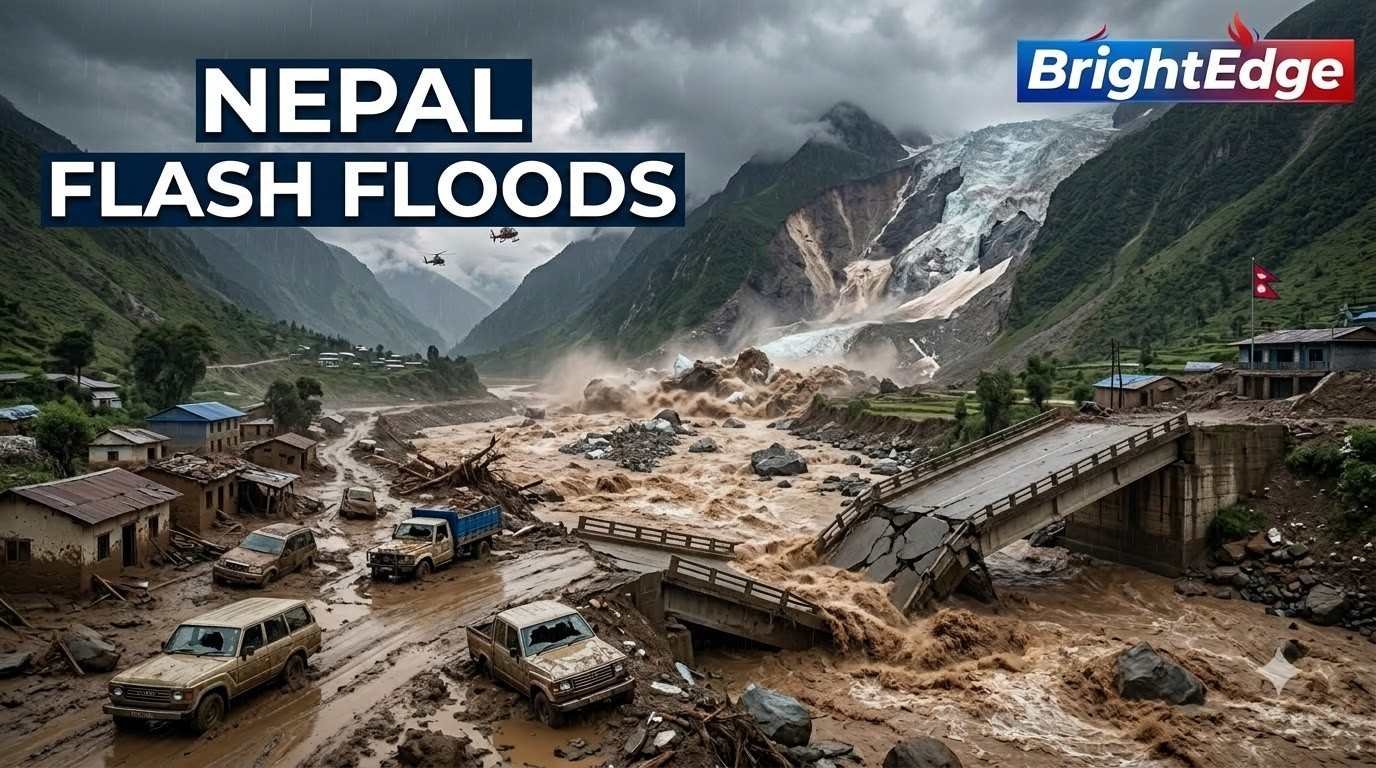
A catastrophic flash flood struck Nepal on August 26, 2026, after a massive collapse of glacier ice, rock and debris in the Himalayan region near the Nepal-China border. The resulting torrent swept through mountain valleys and river systems, destroying homes, roads, bridges and other critical infrastructure.
The disaster also affected areas across the border in Tibet, making it one of the most serious recent natural disasters in the Himalayan region.
According to the U.S. Geological Survey (USGS), the event was likely triggered by a glacial collapse in Langtang National Park. The resulting debris flow and flood travelled nearly 100 kilometres downstream, affecting populated areas along the Trishuli and Bhote Koshi river systems and reaching Gyirong Port in China.
What Caused the Nepal Flash Floods?
- Initial reports raised the possibility that an earthquake had triggered the disaster. However, subsequent geological and satellite analysis indicated that the apparent seismic signal was associated with the collapse of ice and rock itself.
- Satellite imagery showed a substantial section of a glacier breaking away at an elevation of roughly 5,200 metres before crashing towards the valley floor. The resulting ice-rock avalanche generated an enormous debris flow that entered the river system.
- Experts have described the sequence broadly as:
- Glacier collapse → ice-rock avalanche → debris flow → sudden river surge → catastrophic flash flooding
- The disaster demonstrates how a high-altitude glacial event can rapidly transform into a devastating flood hundreds of metres or kilometres downstream.
How Severe Was the Flood?
- The flood carried a destructive mixture of water, mud, boulders, ice and sediment through Himalayan valleys.
- Reuters reported that water levels downstream rose by as much as nine metres within 30 minutes, illustrating the extraordinary speed and force of the event.
- By August 28, reported casualty figures had continued to rise. Reuters reported that the confirmed death toll in Nepal had reached 469, while almost 1,000 people remained missing in Nepal and neighbouring Tibet. Because rescue and recovery operations are still underway, these figures may change.
- The disaster has also affected foreign visitors, pilgrims and trekkers travelling through the Himalayan region. Earlier reports indicated that hundreds of foreign nationals were among those missing.
Which Areas Were Affected?
The disaster struck the mountainous Rasuwa district and surrounding areas before the floodwaters travelled downstream through the river network.
The affected river systems include:
- Lhende River
- Bhote Koshi River
- Trishuli River
The flood also crossed into areas of Tibet, where the Gyirong border region and associated infrastructure were severely affected.
USGS analysis indicates that the debris and flood travelled approximately 100 kilometres, demonstrating the enormous geographical reach of the event.
Roads, Bridges and Infrastructure Destroyed
The fast-moving flood and debris flow destroyed or severely damaged critical infrastructure.
Reports indicate damage to:
- Roads and highways
- Bridges
- Villages and houses
- Hydropower infrastructure
- Border facilities
- Electricity infrastructure
- Tourist and pilgrimage routes
The affected corridor is particularly important because it connects Nepal with Tibet and is used by tourists, trekkers, pilgrims and commercial traffic.
The destruction therefore presents not only a humanitarian challenge but also a major infrastructure and connectivity problem for the region.
Why Was the Glacier Collapse So Dangerous?
- Glaciers store enormous quantities of ice at high elevations. When a large section suddenly collapses, the falling ice can pick up rocks, soil and other material.
- If this material enters a river valley, it can create a rapidly moving mixture of:
- Ice + rock + mud + water + sediment
- That mixture can travel much faster and with substantially greater destructive force than an ordinary river flood.
- The Nepal event is particularly significant because the collapse occurred in a steep Himalayan environment, allowing the debris and water to accelerate rapidly downstream.
Did Climate Change Cause the Nepal Floods?
- Scientists are examining the possible role of climate change, but it would be premature to describe the disaster as being caused solely by global warming.
- Researchers have long warned that rising temperatures are destabilising glaciers and permafrost across the Hindu Kush-Himalaya region.
- Reuters reported that Nepal’s glaciers lost close to one-third of their ice over roughly three decades, while the UN reported in 2023 that glacier melt in Nepal had accelerated significantly during the previous decade.
- The scientific picture is therefore more nuanced: Climate warming can increase glacier instability and related hazards, but establishing a direct causal link for one specific collapse requires detailed investigation.
Why the Himalayas Face Increasing Glacier Risks
The Hindu Kush-Himalayan region contains thousands of glaciers and provides water to enormous populations across Asia.
Rising temperatures can contribute to:
- Glacier retreat
- Permafrost thaw
- Rock-slope instability
- Glacial lake formation
- Ice and rock avalanches
- Landslides
- Glacial lake outburst floods
- Sudden debris flows
Experts warn that the combination of warming temperatures and fragile mountain terrain can create increasingly complex disaster risks.
Rescue Operations Underway
Nepalese authorities and rescue teams have been searching through mud and debris for survivors.
Helicopters have been deployed to assist with rescue and recovery operations, while heavy machinery is being used to clear debris from affected settlements.
However, rescue operations remain extremely difficult because of:
- Destroyed roads
- Blocked river valleys
- Unstable slopes
- Heavy debris
- Damaged bridges
- Remote mountainous terrain
- Risk of additional flooding
Authorities have also been monitoring the possibility of further flooding because debris can temporarily block rivers and create unstable water bodies upstream.
Why This Disaster Matters for India
The Nepal flash floods are also important from an Indian current-affairs perspective.
Nepal’s rivers are part of the wider Himalayan river system that ultimately connects with India’s major river networks. Extreme events in the Himalayas therefore have implications for downstream flood management, hydropower, infrastructure and disaster preparedness.
The disaster also highlights the importance of:
- Cross-border disaster coordination
- Satellite monitoring
- Glacier surveillance
- Early-warning systems
- Himalayan infrastructure planning
- Climate-risk assessment
- Rapid evacuation mechanisms
For India and other Himalayan countries, the event provides another warning that disaster preparedness must account for rapid-onset glacier and debris hazards, not just conventional monsoon flooding.
What Is a Glacial Collapse?
- A glacial collapse occurs when part of a glacier becomes unstable and breaks away from its position.
- A collapse can generate an avalanche containing ice and rock. If that avalanche enters a river valley, it can displace water and generate a destructive flood or debris flow.
- This is different from a conventional monsoon flood because the initial trigger can occur suddenly at high altitude, potentially giving communities downstream very little time to react.
Nepal Flash Floods 2026: Key Facts
| Category | Details |
|---|---|
| Date | August 26, 2026 |
| Country | Nepal |
| Region | Himalayas / Rasuwa region |
| Likely trigger | Glacial collapse and ice-rock avalanche |
| Major rivers affected | Bhote Koshi and Trishuli systems |
| Distance travelled | Nearly 100 km |
| Border region affected | Nepal–China/Tibet |
| Major hazards | Flash flood, debris flow, landslide |
| Rescue status | Ongoing |
| Casualty figures | Still being updated |
USGS confirms that the debris flow and flooding travelled nearly 100 km downstream, while Reuters reports that casualty and missing-person numbers were still evolving as rescue teams continued their work.
What Does the Nepal Disaster Teach Us?
- The 2026 Nepal flash floods underline a crucial lesson: Himalayan disasters can develop extremely rapidly and cross administrative and national boundaries.
- Monitoring rainfall alone is not enough. Modern Himalayan disaster preparedness increasingly needs to combine:
- Satellite imagery + seismic monitoring + glacier observation + river-level sensors + early-warning systems + rapid evacuation plans.
- The disaster also highlights the importance of carefully assessing infrastructure development in environmentally fragile mountain regions.
Conclusion
- The Nepal Flash Floods 2026 have emerged as a major Himalayan disaster, with a devastating combination of glacier collapse, ice-rock avalanche, debris flow and sudden flooding.
- The event is particularly significant because it demonstrates how a high-altitude geological event can trigger destruction far downstream. As rescue teams continue searching affected areas, authorities and scientists are also examining the broader implications for climate change, glacier stability, infrastructure planning and disaster preparedness.
- For the Himalayan region, the message is clear: glacier-related hazards are no longer a distant environmental concern—they are an immediate disaster-management challenge.
Click Here to Read: Who is Balendra Shah? Nepal’s Youngest PM Sworn In After Youth Uprising
Click Here to Read: Bhumika Shrestha Becomes First Transgender Woman to Enter Nepal Parliament